
Gateway Conservation Zone
Old Lyme River's Edge, Kathleen DeMeo
Why It’s Important
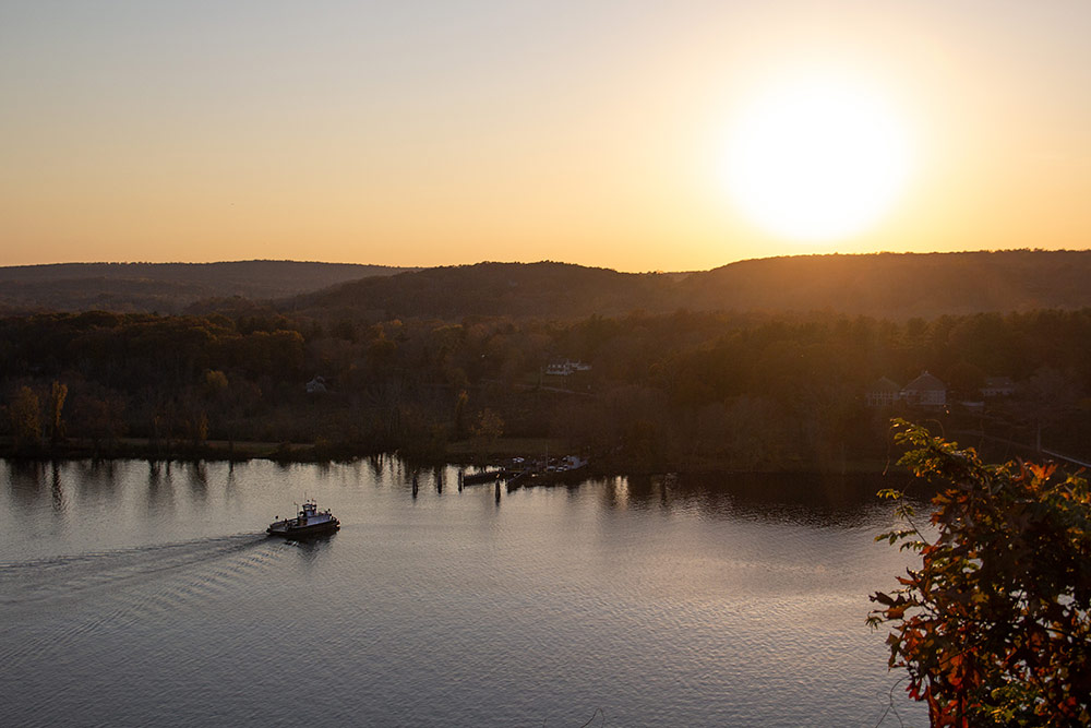
The beauty and ecological health of the lower Connecticut River and its marshes is internationally celebrated.
See some of its honors and tributes.
Due to what’s been called “luck” or a “freak of nature,” the Connecticut River’s sandbars at its mouth prevented the type of large scale industrial development often found elsewhere.
A grassroots movement in the 1970’s arose to ensure that the river valley’s scenic nature would not forever be lost to haphazard growth.
A State plan of conservation and development issued about 50 years ago wrote, “The Connecticut River has many rare, beautiful unspoiled sections compared to other rivers in the heavily populated Eastern United States. From Haddam to the Sound, it is a remarkable diversity of scenery and natural life.”

Connecticut’s US Senator Abraham Ribicoff, testifying in support of legislation creating the Zone in 1973, said, “The river is one of the great natural beauties. If you don’t preserve it, developers, industrialists, fast buck operators will take over and we will have a dumping ground.”
We can be thankful today that his dire warning has not come to pass.
Credit is due to the eight town municipal governments who work cooperatively with the Gateway Commission in the Zone, the people who live or work along the river, and all who visit or boat on the waterway.
The river’s exceptionally picturesque landscape, its thriving wildlife, and its recreational opportunities are what bring most of us to this little piece of heaven.
It is our responsibility as “stewards” to protect this treasure for our children and their children, as earlier generations have done for us.

What is the Zone?
The Zone is a simplified name for the Gateway Conservation Zone that was created by state law in the early 1970s and adopted by eight lower river valley towns.
It is located in parts of East Haddam, Essex, Chester, Deep River, Haddam, Lyme, Old Lyme, and Old Saybrook.
Basically described, the Zone is that area of the lower river valley’s hillsides, shoreline and marshland that can be seen from the river, and from land across the river. This includes various coves and tributaries as well as the main river channel.

The Zone extends roughly 20 miles “as the crow flies” from its far northern boundary down to the Connecticut River’s mouth between Old Saybrook and Old Lyme. As the river meanders south to Long Island Sound, it forms 59 miles of shoreline in the Zone.
This lower Connecticut River valley features numerous state parks, famous landmarks such as Gillette’s Castle, a ferry that began service before America became independent, a scenic railroad, waterfront dining establishments, homes, marinas, museums, and award-winning theaters. It truly is a special region.
The Connecticut River Gateway Commission was created to preserve the Zone’s “natural and traditional” character and today works cooperatively with the eight towns to blend development with care.
Where is the Zone?
The Zone is specifically described by text in State law through several pages of streets, roads, rivers, and distances that constitute its boundaries.
The legal outline begins at northern Haddam, continues south through Chester, Deep River and Essex to Old Saybrook, crosses the river to Old Lyme, and proceeds north through Lyme and East Haddam to a boundary in Haddam Neck, a portion of Haddam on the east bank of the river.
See Section 25-102c at this link for the statutory description.
While you can read the entire 1,849 word legal text, the Connecticut River Gateway Commission has created an interactive map that makes it much easier for you to view the Zone.
- Look at sections of the Zone in all of its 8 towns. Zoom in to see locations in closer detail or to follow the Zone’s contours along the Connecticut River, its various tributaries, and coves.
- You may also type specific addresses into a search box to find if your home or another site are within the Zone. Clicking on the “home” icon on the map will bring you back to its initial view.
- Geographical coordinates also display as you move your cursor over the map.

A new browser window or tab will open to the RiverCOG website when you click to view the map. To return to the Gateway Commission website, look for your previously viewed window.
Connecticut River Ferries Are Older Than America
Ferries have long been a means to cross rivers. The Chester-Hadlyme Ferry, which began service in 1769, was actually used to transport supplies during the Revolutionary War.
Today the Selden III, operated by the Connecticut Department of Transportation, runs between the two towns providing a scenic, relaxing crossing for cars, bicyclists and pedestrians. Enjoy superb views on board of Gillette’s Castle on board the ferry, especially heading east.